There are just as many mountain lakes as there are mountains in Bosnia and Herzegovina to brighten up your hiking adventures.
Written by Afan Abazović
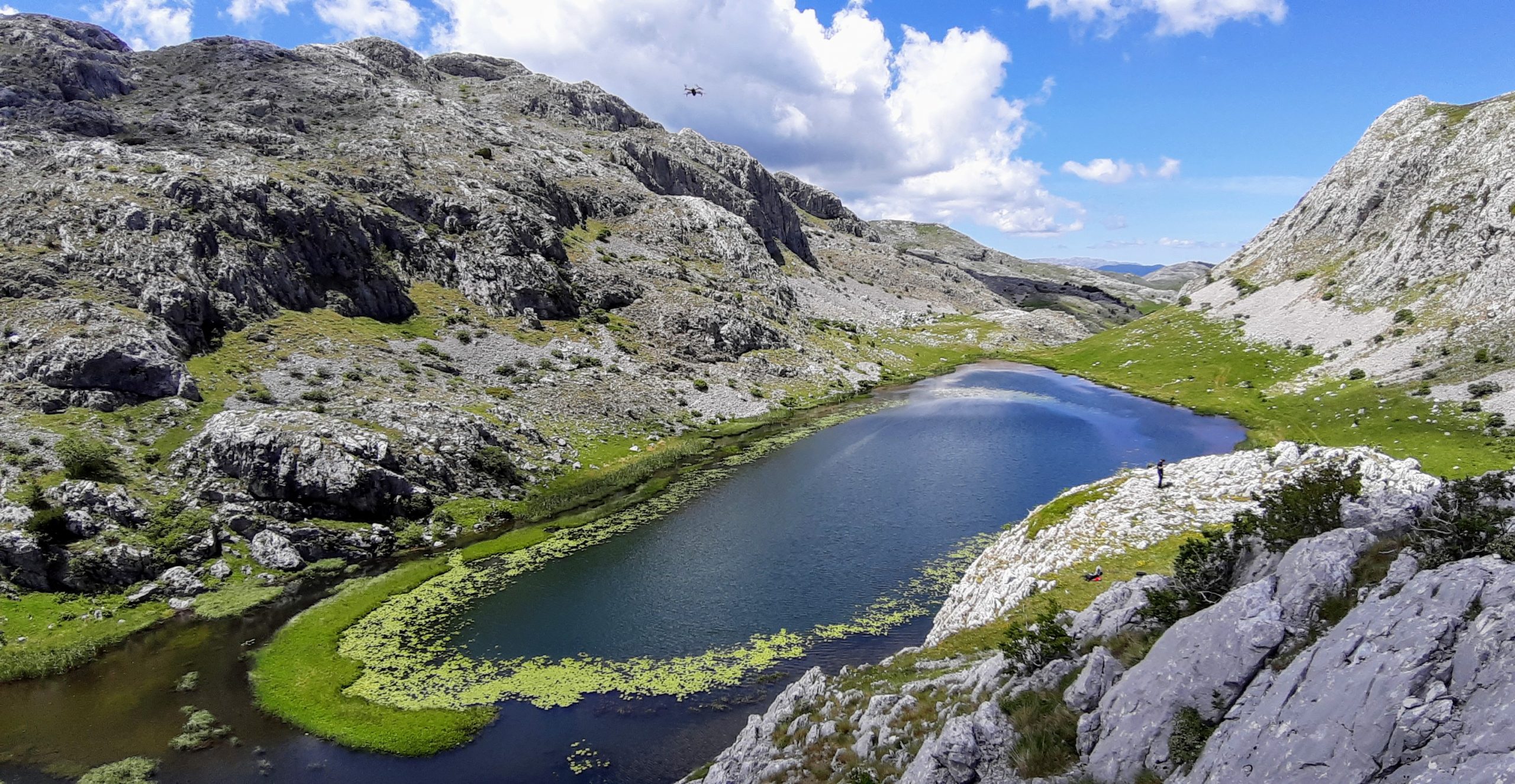
Kladopoljsko Lake in Mount Zelengora
Located in the southeastern part of B&H, Mounta Zelengora is one of the most sought-after hiking destinations. Even though the roads leading to Zelengora are in poor condition, it will always be on all nature lovers’ bucket list as a place to go to at least once a year. It features several lakes of different origin also known as “mountain eyes”. The most accessible lake for a one-day hiking tour in Mount Zelengora is Kladopoljsko Lake.
You can reach the starting point of the hiking tour it you take the R433 road going through Kalinovik towards Ulog and Nevesinje. Ten kilometres after Kalinovik, follow the road sign to “Obalj” on the left. Then, after three kilometres of paved and unpaved road surfaces, you come to an ancient necropolis where you can park your car. To make it meaningful, pleasant and appealing to the eye, we suggest you make a circular tour spanning 15 km in total. The initial section takes you across Suho polje to the abandoned barns in Kladovo polje, near which the Krupac spring is located. From there, the trail practically takes you in the same direction to Kladopoljsko Lake.
Hikers of average fitness level can make the hike to the lake in three and a half hours. It is located on the west side of the mountain massif and is completely separated from the dense group of lakes in the central part of Mount Zelengora. Located at 1380 metres above sea level, Kladopoljsko Lake is about 250 metres long and about 100 metres wide. It falls under the protection of the Sutjeska National Park. It is also suitable for fly fishing, a special style of fishing, and is extremely rich in fish life.
On your way back from the lake, you will see an important national monument of B&H which is inscribed on the UNESCO World Heritage List—the medieval necropolis Čengića bara consisting of 52 tombstones. After you explore the tombstones from medieval Bosnia, particularly those with scrolling vines, floral stylisations, and bird and deer motifs, head north towards Suho polje, and finally go back to your car.
Šatorsko Lake in Mount Šator
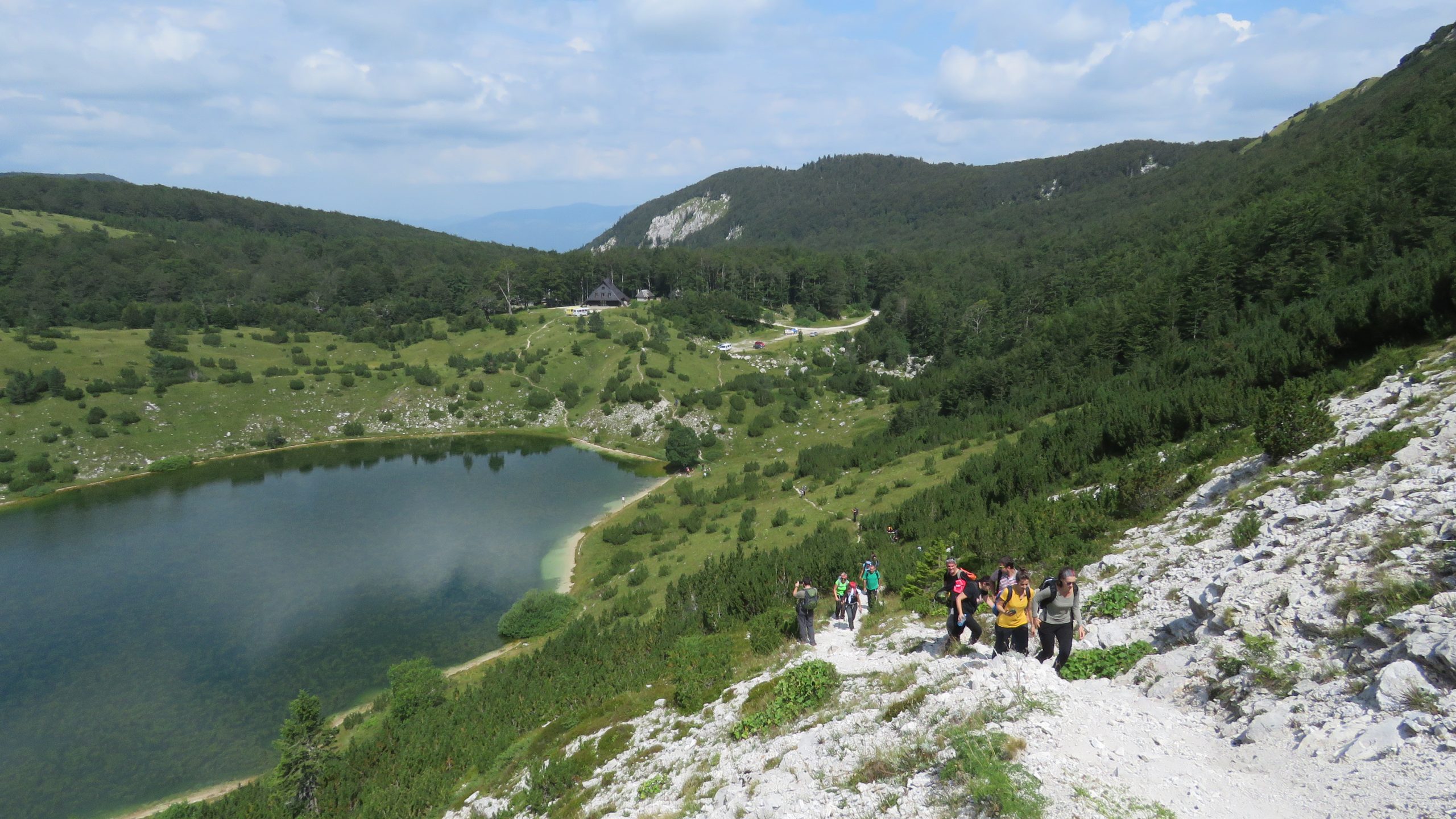
Western Bosnia is an area with awfully interesting types of terrain and biological diversity. However, since it is quite far from the central part of the country, we have not derived much benefit from it. One of the lesser known and unfairly neglected mountains in Bosnia and Herzegovina is Mount Šator near Bosansko Grahovo. Its highest peak, Veliki Šator, is situated at 1872 m above sea level. Šatorsko Lake is what makes the mountain unique. Glacial in origin and sitting at an elevation of 1488 metres above sea level, it is 280 metres long and 120 metres wide. Šatorski potok flows from Šatorsko Lake and forms the Unac River further downstream.
You can drive to the lake by car. Take main road to the village of Gornje Peulje, which sits between Livno and Bosansko Grahovo, and then continue along the 17-kilometre long macadam road to get to the “mountain eye”. On the plateau above the lake there is mountain lodge run by “Edelweiss” Mountaineering Association, which is open to the public as needed so you need to announce your arrival in advance. The hike to the top of the mountain and back to the lake is a total of 8 kilometres. The trail, initially steep and rocky, takes you to a mountain saddle, leads onto an old road and then upwards to toward the peak of Veliki Šator. The view from the top extends to the nearby Dinara, Troglav, Kamešnica, and Cincar mountains, then to Čvrsnica and Raduša mountains and further to the mountains of central Bosnia. You will get back down the same way you came up.
Do not be surprised if you see a small white star flower along the trail—it is an endemic mountain flower called edelweiss, a symbol excellence in mountaineering activities. In the lake’s immediate surroundings, make sure you visit Bulino vrelo. Its waters are reputed to have healing properties.
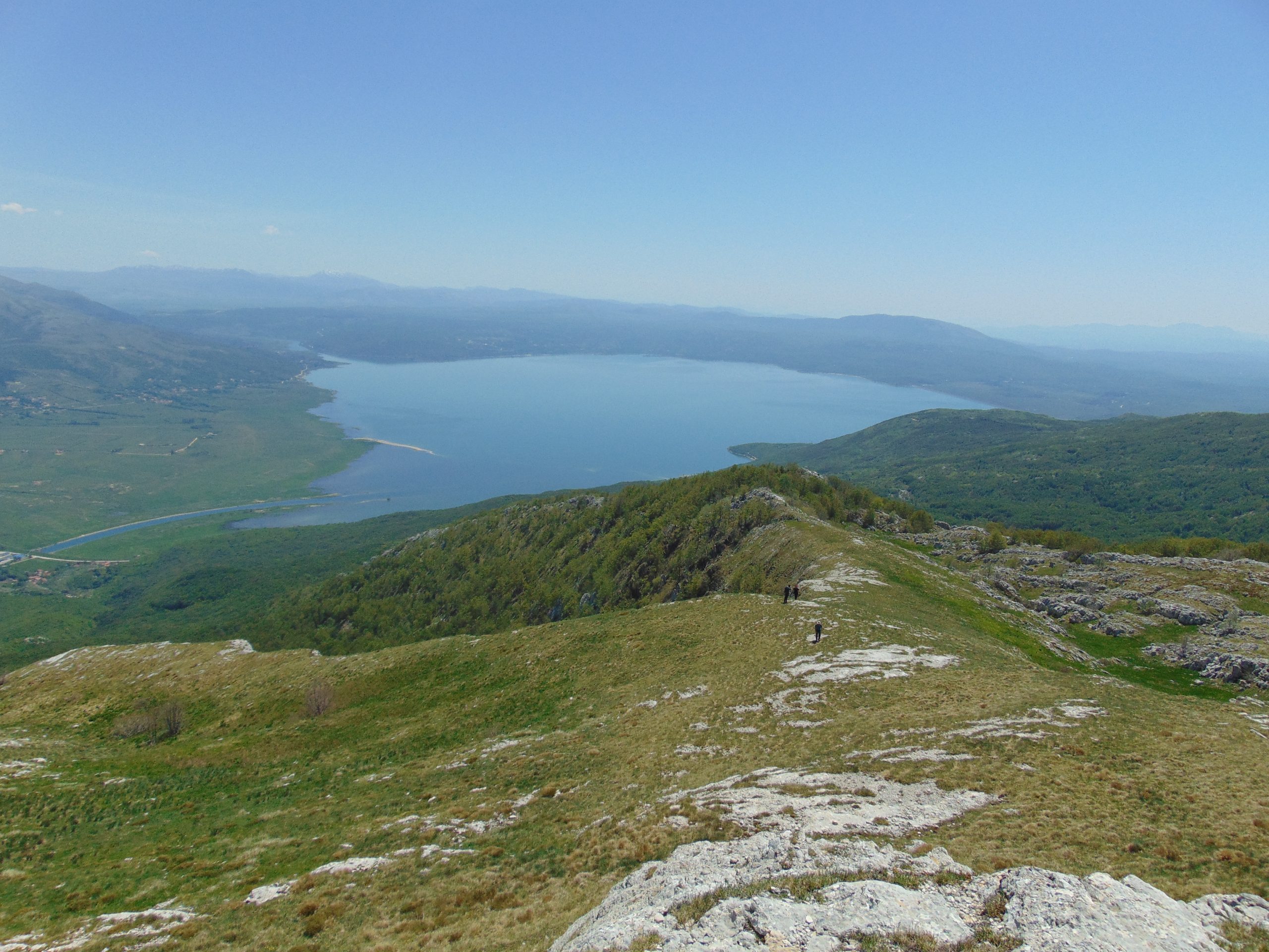
Buško Lake Near Mount Kamešnica
Buško Lake is known as the largest artificial lake in Bosnia and Herzegovina. However, few people know that it was formed on the former Buško blato at an altitude of 700 meters. The mountain that rises above Buško Lake is Kamešnica and is a border mountain between B&H and Croatia. The highest peak sitting at 1856 meters above sea level is called Konj. It appeals to hikers very much. The ascent usually begins from the village of Podgradina, which is situated on the banks of Buško Lake, and takes you on an 11-kilometre route. During the 5.5 km ascent and then descent, you have to adjust to an elevation change of nearly 1,150 metres, which is why this trail is considered one of the most difficult trails in the country.
The trail starts near the Ozren spring and takes you first through the maquis, then through the beech forest all the way to the mountain lodge and to the Pešino spring, which is halfway through the hike. The lodge was built thanks to the work of “Kamešnica” Mountaineering Association from Livno. After a short rest, continue your hike, but do not forget to refill your water bottles because soon enough you will reach the summit of the ridge and be exposed to intense Herzegovinian sun and heat.
At the top you will find a concrete geodetic pillar and you will be able to see nearby mountains—Troglav, Dinara, Tušnica, Cincar, and Šator. On your way back, tighten the laces on your hiking shoes and be gentle with your feet.